01 / Geology
Geology · geophysics
High-resolution sub-bottom profiles for geologic layering and geophysical surveys.
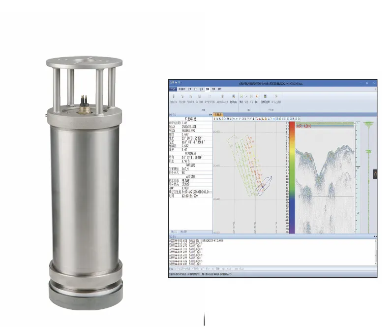
SE-3 integrated parametric SBP—primary ~300 kHz tier, wide difference band, simultaneous depth and penetration; compact transducer for USV/AUV/ROV integration. It focuses on Proven parametric array, Primary ~300 kHz, ~20 m penetration, ready to connect with sounding, navigation, or monitoring workflows. Typical uses include Geology · geophysics, Pipeline · cable route, Dredge sediment analysis.
SE-3 integrated parametric SBP—primary ~300 kHz tier, wide difference band, simultaneous depth and penetration; compact transducer for USV/AUV/ROV integration.
Nonlinear difference-frequency tech—narrow-beam high-res profiles with precision depth in the same pass.
Primary 269–331 kHz, ~3.5° primary beam, difference beam 2.9–3.9°—more focused energy.
Difference 10–40 kHz, ~20 m penetration (seabed/noise dependent), 400 m operating range.
Transducer ~8 kg in air / 4 kg in water; stainless or titanium shell; USV-capable.
SE-3 transmits two high primary tones; nonlinear mixing in water creates a low difference frequency—HF for precision depth, difference for sub-bottom profiles.
Primary about 269–331 kHz with a narrow downward beam and high source level for clear depth.
Difference 10–40 kHz (10/12/14/16/18/24 selectable) penetrates sediments for profiles.
Optional BDS/GPS and IMU with heave correction; RJ45 / RS485 control.
GeoMaster Chinese acquisition/processing; compatible with SonarWiz, HYPACK, and more.
Versus SE-2 in the same family, SE-3 uses a higher primary and narrower beams for finer-resolution profiling.
Shallow geology, pipeline routes, minerals and dredge sediment analysis, plus harbor/inland depth and silt surveys.
High-resolution sub-bottom profiles for geologic layering and geophysical surveys.
Pipeline route and cable-lay surveys—locate burial depth and obstacles.
Dredging sediment investigations—silt thickness and siltation change.
Ultra-shallow harbors and inland lakes/reservoirs—depth mapping and silt analysis.
Key parameters for SE-3 (from the product page and sales description).
| Model | SE-3 |
| Brand | 南方海洋 |
| Product type | Sub-bottom profiler |
| Frequency | ~300 kHz Primary |
| Penetration | ~20 m |
| Beam | 3.5° / 2.9–3.9° |
| System | Integrated · ~8 kg |
| Key points | About 300 kHz primary, 10–40 kHz difference frequency, penetration about 20 m. Primary 269–331 kHz, ~3.5° primary beam, difference beam 2.9–3.9°—more focused energy. ~20 m penetration. Typical use: Geology · geophysics; Pipeline · cable route; Dredge sediment analysis; Harbor · inland shallow. |
| Applications | Geology · geophysics; Pipeline · cable route; Dredge sediment analysis; Harbor · inland shallow |