01 / Rivers & Lakes
River · lake sounding
With FreeGo navigation survey software, run high-accuracy depth surveys on rivers and lakes with a familiar field workflow.
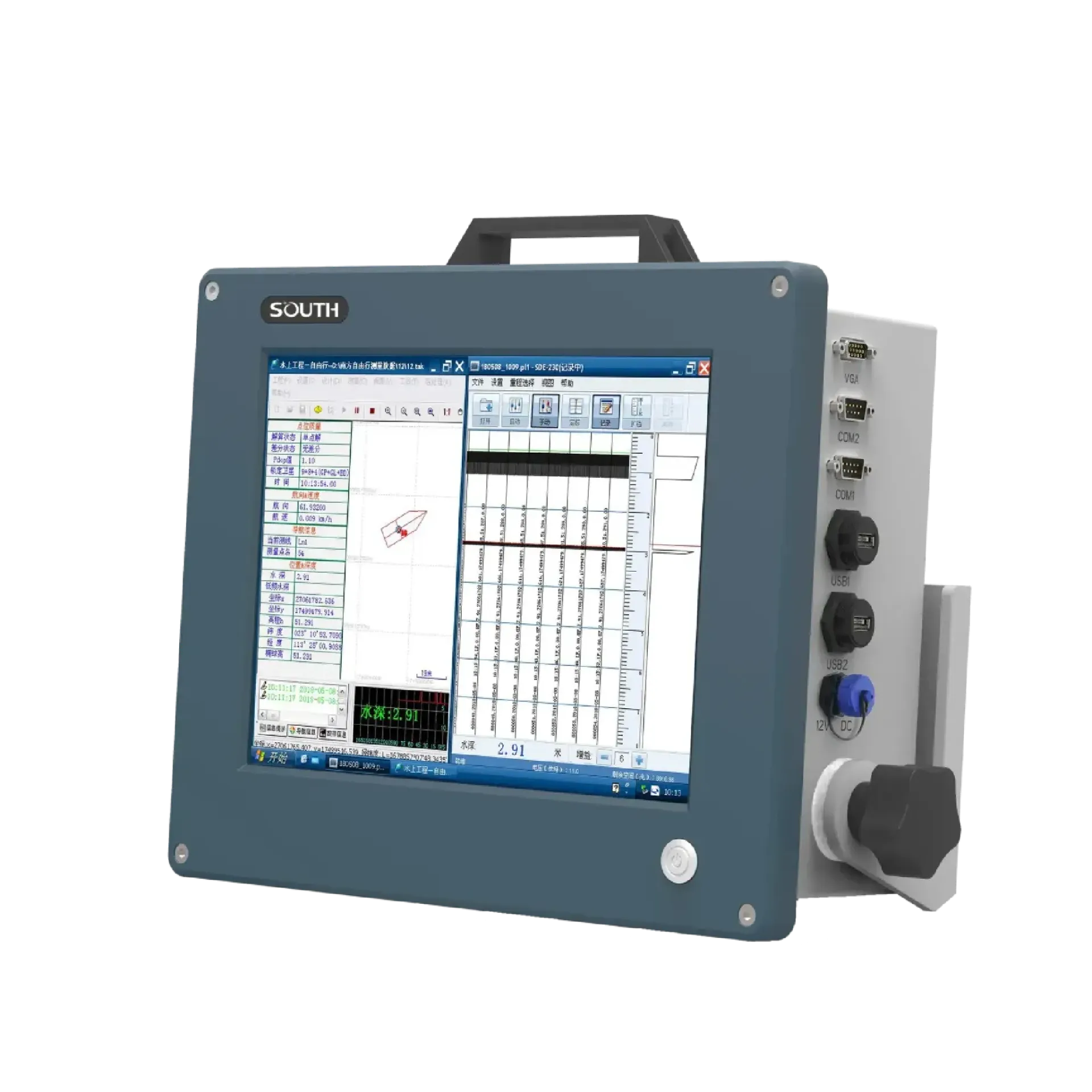
SDE-28S upgrade: refined circuits and stability, industrial Windows with sounding + chart nav, 0.3–600 m for rivers to seas. It focuses on 12.1″ bright touchscreen, Sounding + navigation in one, High-speed DSP stability, ready to connect with sounding, navigation, or monitoring workflows. Typical uses include River · lake sounding, Harbor · channel survey, Nearshore · marine sounding.
SDE-28S upgrade: refined circuits and stability, industrial Windows with sounding + chart nav, 0.3–600 m for rivers to seas.
High-brightness LED LCD with 5-wire resistive touch—readable in sunlight, easier on deck.
Built-in SOUTH FreeGo-class software for survey, nav, positioning, mapping, and post-processing in one flow.
DSP stabilizes waveforms and depth; auto pulse width/gain/power—more reliable in complex waters.
200 kHz / 5° narrow beam covers shallow to 600 m; accuracy 0.01 m±0.1%·D.
SDE-28S+ drives a survey transducer from an industrial host, firing 200 kHz, 5° narrow-beam ultrasound and solving time-of-flight for centimeter-level depth.
A 200 kHz survey transducer fires a 5° narrow-beam ultrasonic pulse downward—focused energy with strong directionality.
The pulse reflects from the bottom back to the transducer; the narrow beam cuts sidelobes for a clean echo.
High-speed DSP measures transmit–echo time and converts it to depth D using the speed of sound.
Serial links to GNSS and FreeGo software record depth curves for live playback and printout.
From shallow channels to nearshore deep water—range, accuracy, beam, and industrial environment in one view.
Precision river/lake sounding, harbor channels and dredging, plus marine depth work—SDE-28S+ makes nav sounding more efficient.
With FreeGo navigation survey software, run high-accuracy depth surveys on rivers and lakes with a familiar field workflow.
Harbor and channel depth surveys with multi-serial and external GNSS—easy to plug into shipboard workflows.
0.3–600 m range and up to 300 W transmit cover nearshore and deeper marine depth work.
Before/after dredging depth compare and construction monitoring—centimeter resolution tracks dig depth and siltation.
Key parameters for SDE-28S (from the product page and sales description).
| Model | SDE-28S |
| Brand | 南方海洋 |
| Product type | Single-beam echo sounder |
| Range | 0.3 – 600 m |
| Precision | ±1 cm |
| Beam | 5° narrow beam |
| Platform | Win7 · 12.1″ · ~6 kg |
| Key points | 200 kHz, 5° beam, industrial all-in-one sounding from 0.3–600 m. Industrial Windows platform with touch navigation sounding for rivers, seas, and dredging. Typical use: River · lake sounding; Harbor · channel survey; Nearshore · marine sounding; Dredging survey. |
| Applications | River · lake sounding; Harbor · channel survey; Nearshore · marine sounding; Dredging survey |