01 / Hydrology
Hydrology
Routine monitoring on rivers, lakes, reservoirs, and hydraulic sections.
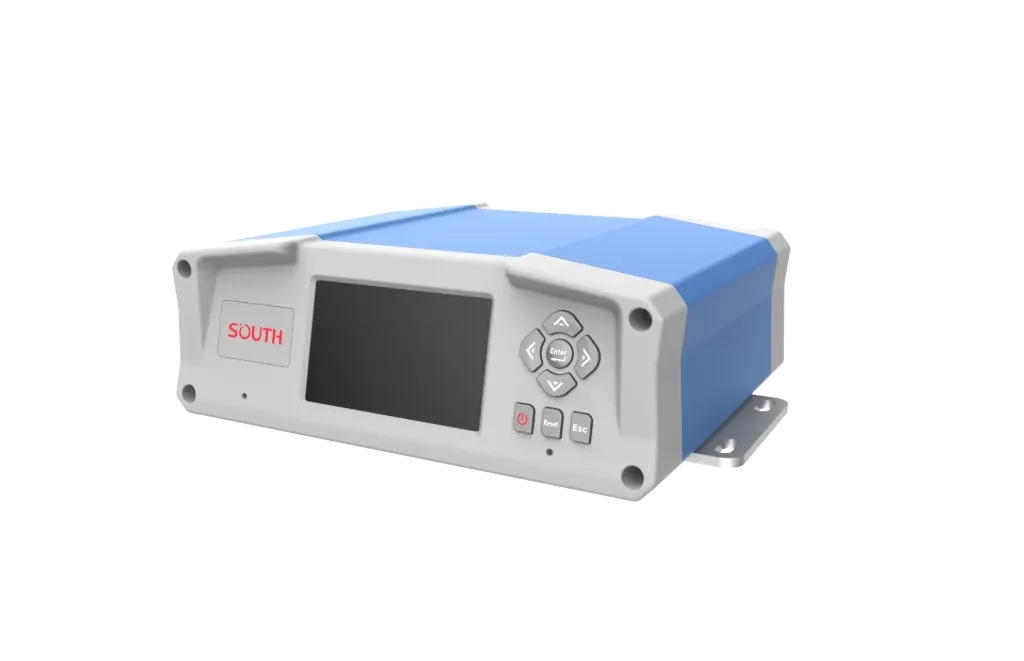
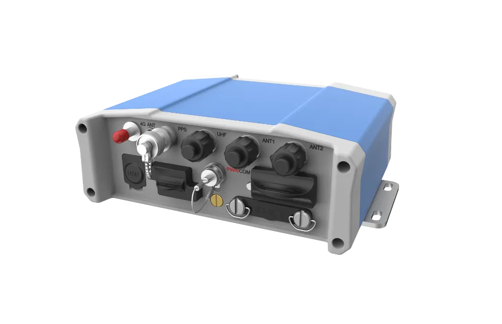
S83D Marine delivers multi-GNSS RTK and dual-antenna heading with Web UI for vessel configuration. It focuses on 1598-channel all-GNSS, RTK and PPP, Dual-antenna heading, ready to connect with sounding, navigation, or monitoring workflows. Typical uses include Hydrology, Harbor and marine, Engineering.
S83D Marine delivers multi-GNSS RTK and dual-antenna heading with Web UI for vessel configuration.
Tracks BDS/GPS/GLONASS/Galileo/QZSS and more; 1598 channels; initialization <10 s; reliability ≥99.99%.
RTK 8 mm+1 ppm H / 15 mm+1 ppm V; BDS PPP and PPS supported.
Heading 0.0375° at 4 m baseline (0.075° at 2 m); 1–50 Hz P&H output.
2.8″ OLED with key UI; Wi-Fi/USB Web configuration and file transfer.
S83D follows clear collect–process–output steps matched to this product type.
Continuous multi-constellation tracking with cycle-slip control.
Differential position and dual-antenna heading solve together.
1–50 Hz position and heading for nav and sounding.
Configure and check status from phone or PC at sea.
Key figures and field capabilities for S83D, for quick selection.
From routine monitoring to complex engineering sites, choose deployment and data links around the task.
Routine monitoring on rivers, lakes, reservoirs, and hydraulic sections.
Support harbor, channel, marine survey, and vessel engineering work.
Support dredging, placement, pipeline, mapping, and construction checks.
Connect stable outputs to shore stations or remote data platforms.
Key parameters for S83D (from the product page and sales description).
| Model | S83D |
| Brand | 南方海洋 |
| Product type | GNSS&RTK |
| Channels | 1598 |
| RTK | RTK |
| Heading | 0.0375° (@4 m) |
| Protect | IP67 · OLED |
| Key points | 1598-channel multi-constellation GNSS, RTK horizontal 8 mm + 1 ppm. Key figures: 1598 channels, RTK 8 mm+1 ppm, heading 0.0375°/4 m, IP67, OLED. Typical use: Hydrology; Harbor and marine; Engineering; Long-term monitoring. |
| Applications | Hydrology; Harbor and marine; Engineering; Long-term monitoring |