01 / Rivers & Lakes
River · lake sounding
High-accuracy depth with chart navigation for routine and dense river/lake surveys.
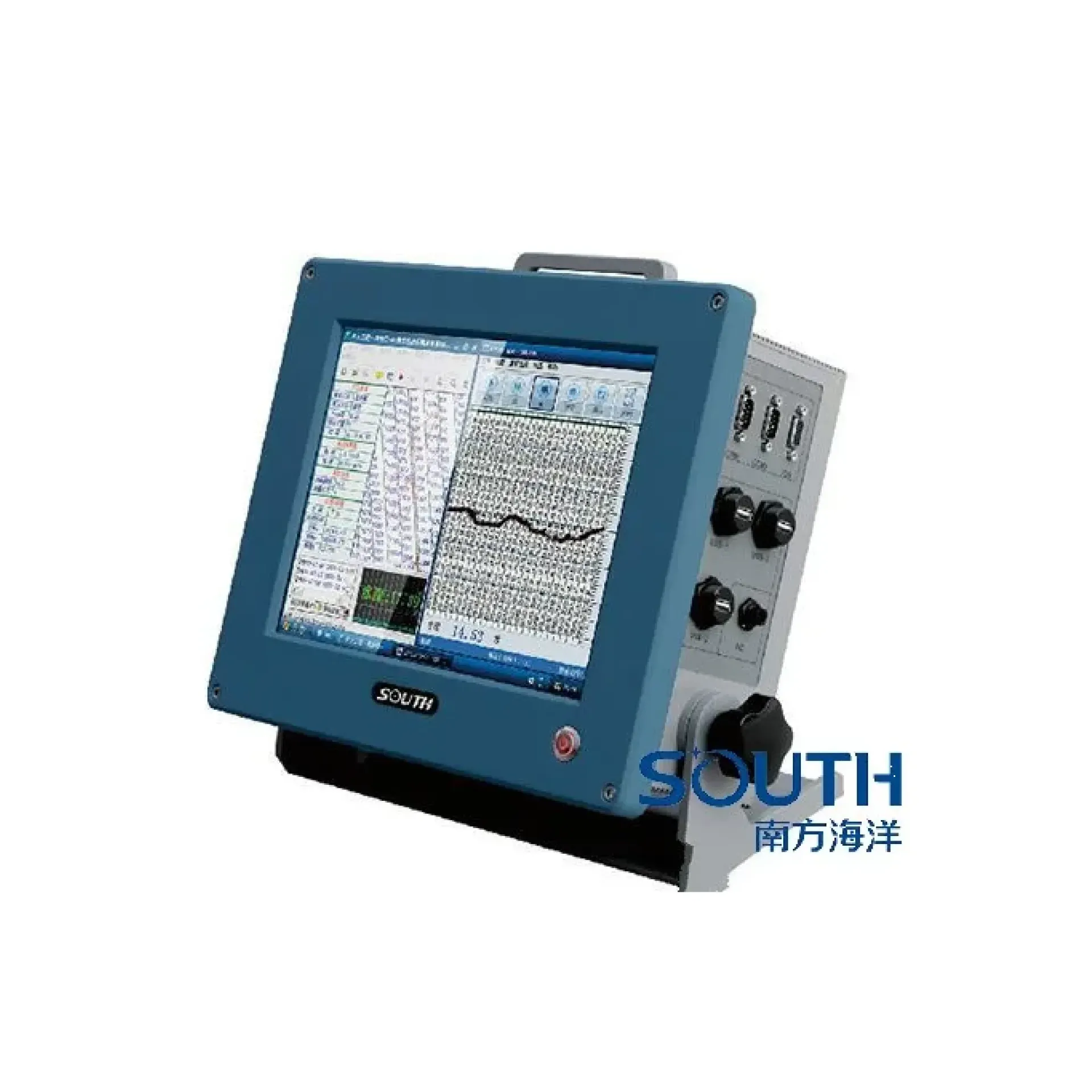
SOUTH next-gen high-accuracy digital sounder—all-metal waterproof/shockproof, high-speed industrial board + slim Windows 7, GNSS-ready for long stable jobs. It focuses on All-metal rugged shell, Nav, sounding, post-process, High-speed DSP + dual filters, ready to connect with sounding, navigation, or monitoring workflows. Typical uses include River · lake sounding, Harbor · channel survey, Engineering positioning.
SOUTH next-gen high-accuracy digital sounder—all-metal waterproof/shockproof, high-speed industrial board + slim Windows 7, GNSS-ready for long stable jobs.
One-piece all-metal housing with multi-face cooling—waterproof and shock-resistant for hard field use.
New software unifies acquisition, navigation, playback, and post-processing with a Chinese UI that matches field flow.
DSP stabilizes waveforms; time/space dual filters and bubble rejection improve reliability in complex waters.
200 kHz / 5°, up to 300 W—shallow to 600 m in one unit; accuracy 0.01 m±0.1%·D.
SDE-230 drives a 200 kHz, 5° narrow-beam transducer from an industrial host, fires ultrasound, receives the bottom echo, and solves time-of-flight for centimeter-level depth.
200 kHz survey transducer fires a 5° narrow-beam pulse downward—focused energy, fewer sidelobes.
Bottom echo returns to the transducer; dual filters and bubble rejection improve detection in complex waters.
High-speed processing converts time to depth by sound speed—1 cm resolution, selectable range scales.
External nav/survey GNSS and compass; FreeGo software completes positioning and mapping.
Deep range, centimeter accuracy, 5° beam, and industrial environment parameters in one view.
High-accuracy river-to-sea sounding, harbor channel maintenance, dredging and engineering surveys—SDE-230 is a workhorse depth system.
High-accuracy depth with chart navigation for routine and dense river/lake surveys.
Harbor pilotage and channel depth maintenance—serial/USB/VGA ready for shipboard PCs.
Geophysical drilling, seismic set-out, and other engineering fixes with a complete nav-survey software flow.
Before/after dredging compare and in-progress sounding—centimeter resolution supports acceptance.
Key parameters for SDE-230 (from the product page and sales description).
| Model | SDE-230 |
| Brand | 南方海洋 |
| Product type | Single-beam echo sounder |
| Range | 0.3 – 600 m |
| Precision | ±1 cm |
| Beam | 5° narrow beam |
| Platform | 32G SSD · ~6.7 kg |
| Key points | 200 kHz, 5° beam, sounding range 0.3–600 m. All-metal housing, industrial Windows, integrated nav/sounding/post-process. Typical use: River · lake sounding; Harbor · channel survey; Engineering positioning; Dredging survey. |
| Applications | River · lake sounding; Harbor · channel survey; Engineering positioning; Dredging survey |